From Ocean Chaos to Calculated Grids: How Modern RCC and Decentralized Networks are Reshaping Maritime SAR
From Ocean Chaos to Calculated Grids: How Modern RCC and Decentralized Networks are Reshaping Maritime SAR
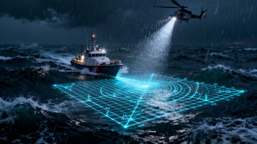
The open ocean is a dynamic and unforgiving environment. When a vessel goes down or a person is lost at sea, a relentless race against the clock begins. Traditional Search and Rescue (SAR) operations relied heavily on static last known positions. Today, Rescue Coordination Centers (RCC) utilize advanced technologies to transform unpredictable waters into a calculable matrix.
The Modern Data Triad: AIS, Satellites, and Drift Modeling
Modern RCC technology, including AIS, satellite imagery, and drift modeling, has transformed how coordinators predict where a distress subject will be found in open water. This technology stack relies on three main pillars:
- AIS (Automatic Identification System): It maps all regional maritime traffic in real time, instantly turning civilian vessels into potential rescue nodes.
- Satellite Imagery: Synthetic Aperture Radar satellites scan the ocean surface for debris or life rafts, even in complete darkness or heavy cloud cover.
- Drift Modeling: As the most critical component, these algorithms use wind, wave, and current data to calculate precisely where a lost target will drift over time.
Thanks to these technologies, coordinators no longer say, "The person was last seen here." Instead, they can state, "Based on current and wind calculations, the subject will be in this exact vector in three hours." However, this perfect command center strategy hits a massive obstacle in the field: Connectivity.
The Edge Bottleneck: What Happens When Communications Fail?
The dynamic drift models and continuously evolving hatched search areas generated by the RCC are data heavy. When rescue boats and helicopters move offshore and out of cellular or traditional internet range, access to this vital intelligence is severed. The best drift model in the world is useless if it cannot reach the rescue team in the middle of a storm.
The Decentralized Solution through Edge Computing
This is where the future of maritime SAR relies on high-stability decentralized communication networks. Hardware supported by robust SPI architectures and LoRa technology creates a closed ecosystem between units, completely bypassing the need for cell towers.
Optimizing bandwidth is the most critical engineering challenge here. To prevent the mesh network from collapsing, heavy visual data must not be transmitted over the air. Instead, complex tactical map elements, such as dynamic hatched search areas, must be processed locally directly on the edge device. By transmitting only essential coordinate and telemetry data over the low-bandwidth mesh network, all field teams remain synchronized on the same MGRS/UTM tactical map.
Ultimately, integrating modern RCC technologies with decentralized communication networks in maritime rescue operations is not just an innovation, it is a necessity. The only way to translate the strategy on the table into salvation on the water is to keep the signal alive.
Tags: #MeshGrid #KeepTheSignalAlive #MaritimeRescue #SearchAndRescue #SAR #DriftModeling #DecentralizedNetworks #EdgeComputing #TacticalMapping #LoRa #EmergencyResponse #RCC