MeshGrid 2.1 is Live: Advanced Map-Based Team Coordination for Maritime Search and Rescue Operations
To ensure uninterrupted communication and map-based team coordination in challenging field conditions, we have released the 2.1 version of MeshGrid. In this update, we focused specifically on the dynamics of maritime Search and Rescue (SAR) missions. Given the unpredictable nature of the open seas, we developed critical tools so teams can quickly access vital data even offline and manage operations from a single map interface.
Here is what is new in MeshGrid 2.1:
SARDRIFT: Current-Based Search Probability Cloud
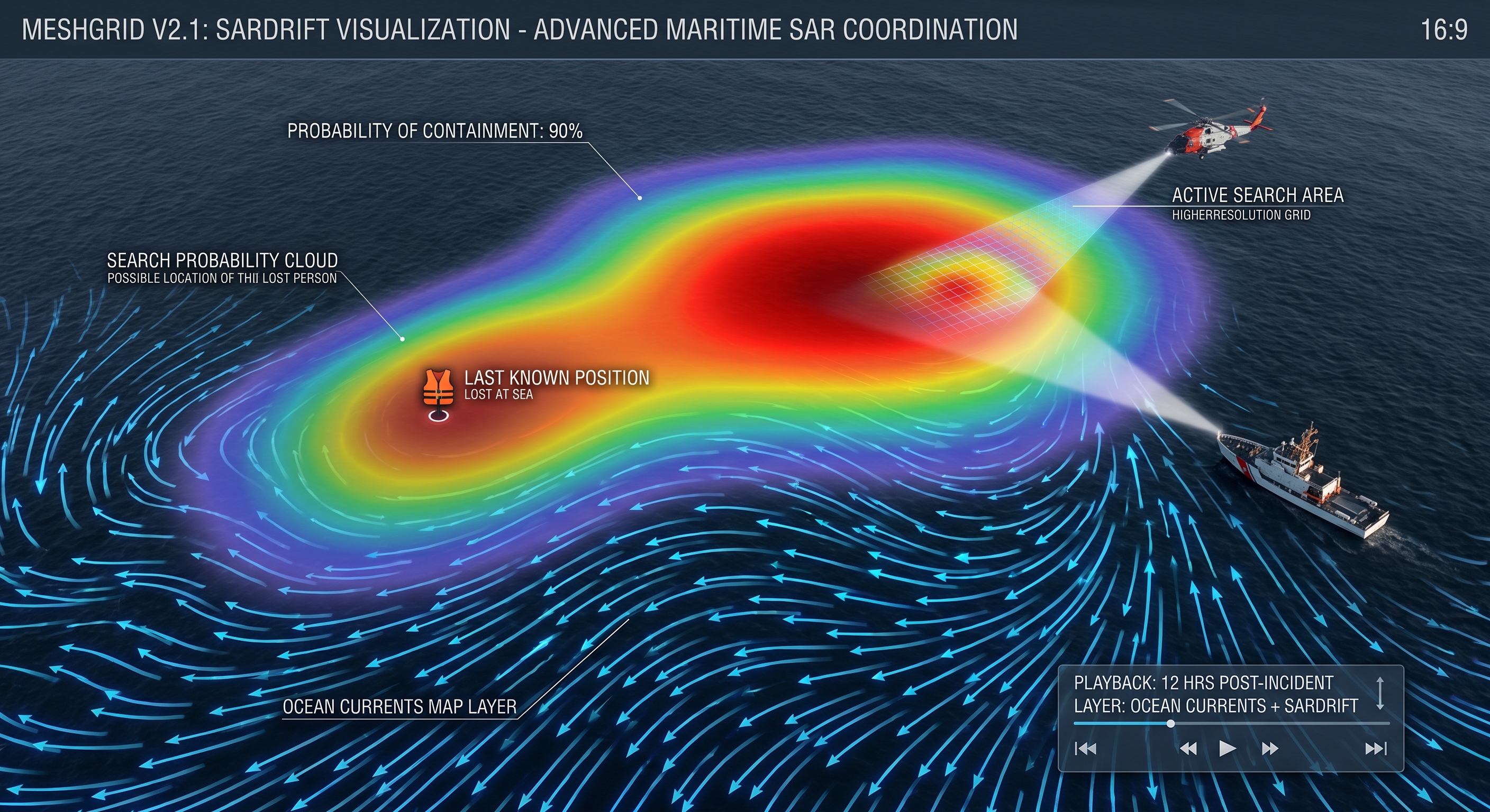
Finding lost individuals or objects in the open sea is a tough race against waves and time. With the newly added Maritime drift SAR (SARDRIFT) feature, a dynamic search probability cloud is generated based on ocean and sea currents. By calculating current direction and speed, this system guides teams to the highest probability search areas in missing person cases. This narrows down the search area, saves time, and directly increases the chances of a successful rescue.
Live Ocean Currents and Offline Cache
To support the SARDRIFT infrastructure, we introduced the new Ocean Currents Map Layer. This layer visualizes current directions with animated flow and playback controls. The most crucial detail is the offline cache support. During open sea operations where internet connectivity is completely lost, pre-cached current data continues to be displayed seamlessly on the map.
New Environmental Map Layers: Fog, Visibility, and Air Quality
During maritime operations, a sudden drop in visibility can alter all plans. To help teams foresee environmental risks, new map layers containing fog, visibility, and air quality data have been integrated into the system.
A Faster, Cleaner, and More Reliable Experience
When every second counts in the field, the application must respond rapidly. Accordingly, we made the following improvements to the user interface and overall performance:
- * Clearer Map HUD Controls: The Head-Up Display (HUD) layer controls on the map have been made clearer, and a dedicated menu for layers has been added.
- * Faster Settings: The Settings menu now operates much faster when multiple map layers are enabled.
- * Improved Performance: Location accuracy, mesh peer overlays on the map, and overall map performance have been made more reliable and stable.
- * Ops and Localization: Localization updates and improvements to Ops purchase messaging have been completed.
- * You can download the latest version of MeshGrid today to enhance your team's map-based coordination power in the field.